Illinois has over 120,000 miles of rivers and streams that provide water essential for drinking, habitat, industry, agriculture, and flood control to our communities. Prairie Rivers Network works to protect these resources and see that they are as healthy and clean as needed to support all of their uses.
River Anatomy

Watersheds
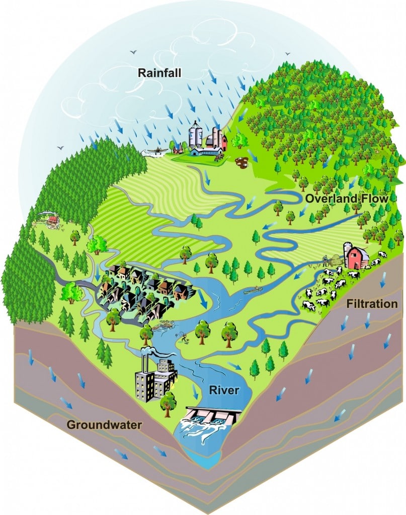
 A watershed is an area of land which drains to a common waterway, such as a river or river system. Natural features such as hills, ridges, or other elevated land areas form a watershed’s boundaries. Watersheds cover both small and large areas of land.
Your own neighborhood is part of a watershed. When it rains some water is absorbed into natural surfaces covered by grass, trees, and gardens. Rain that falls on “hard” (impermeable) surfaces like your street, your next-door neighbor’s roof, or a nearby parking lot flows downhill into the nearest storm drain or stream. This water (or “runoff”) collected by these smaller streams eventually flows into larger streams.
Not all precipitation will complete this journey and empty into the outlet point. Some water seeps deep into the soil and becomes part of the groundwater supply, water that is held underground in soil or rock. Groundwater is stored in aquifers, underground bodies of rock that move water through the porous, or empty, spaces in the rocky material. The larger and better connected these pores are, the quicker the water is able to travel. Aquifers supply almost all water for human use, and they can become depleted due to excessive pumping for many uses.
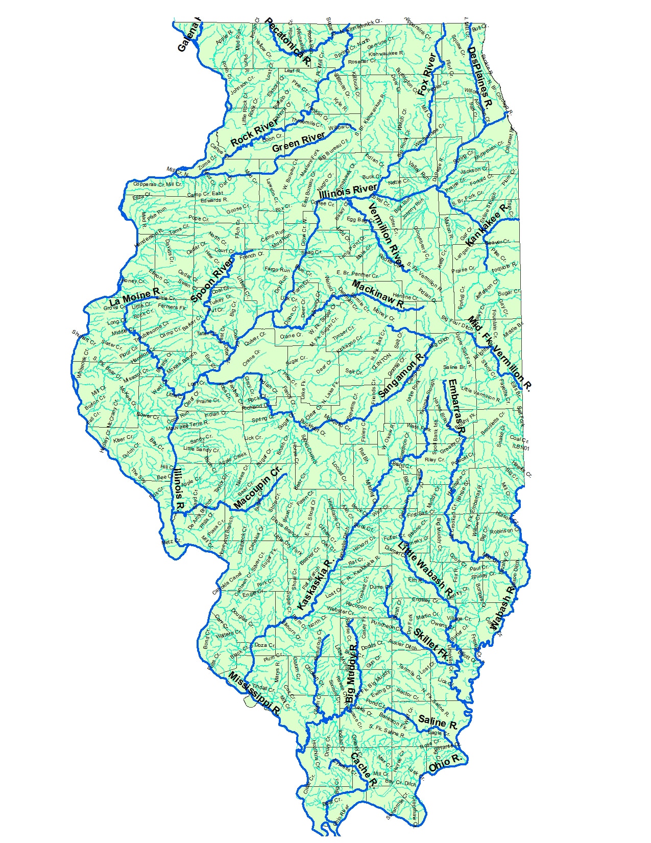
The state of Illinois, except for the Lake Michigan watershed, is also part of the Mississippi River Basin, the fourth largest watershed in the world (the Lake Michigan watershed is part of the Great Lakes Basin). Illinois contains 24 major watersheds.
Prairie Rivers Network focuses on strengthening the large-scale water protections that will preserve the quality and quantity of our water now and for future generations. Read on to see how we do that, and how we need your help.
Check out the Environmental Protection Agency’s Surf Your Watershed program site to find out more about the watershed you live in and discover how you can help protect it at the Environmental Protection Agency’s training module.
Pollution Threats to our Rivers
 Literally thousands of pollutants find their way into Illinois rivers. These chemical and biological pollutants include pesticides, fertilizers, nutrients, metals, organochlorines, pharmaceuticals, pathogens, and sediment. Pollutants vary greatly in their toxicity and physiological and ecological effects. Environmental damage that can result from water pollution ranges from alteration of sub-cellular functions in aquatic organisms to changes in large-scale ecosystem processes. Sources of pollution are divided into the broad categories of “point source” and “non-point source.”
Point Source
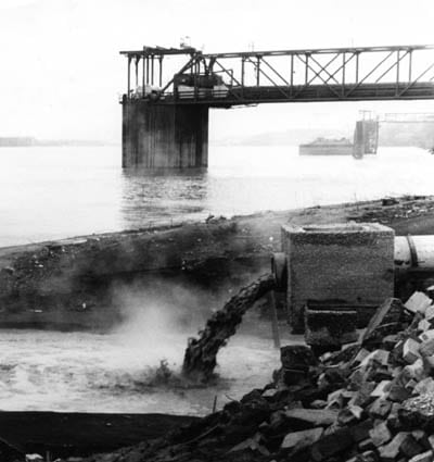
Point sources are defined by the Clean Water Act as “any discernible, confined and discrete conveyance” of pollutants to a river. Conveyances include pipes, ditches, channels, tunnels, and conduits. Point sources are regulated by the Clean Water Act, and must have a National Pollutant Discharge Elimination System (NPDES) permit to discharge into rivers. These permits limit the allowable amount of pollutants in the discharge. Some examples of point sources are:
- Sewage treatment plants
- Factories
- Urban storm drains
- Confined animal feeding operations (CAFOs)
- Floating vessels
- Construction sites
Non-Point Source
Non-point source pollution is polluted runoff that results from rain or melting snow carrying pollutants from land to water. Non-point source pollution is the largest contributor to water degradation in the state. Non-point sources are not regulated in the same way as point sources, but state and federal programs exist to reduce the potential for runoff to contaminate rivers. Non-point source pollution results from land disturbance activities such as:
- Agriculture
- Mining
- Forestry
- Urban development
Pollution in the Illinois River
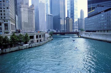
The Illinois River stretches for 273 miles and drains over 30,000 square miles of land. Its basin includes 46 percent of Illinois’ agricultural land and 95 percent of its urban population.
One of the greatest threats to streams in several areas of Illinois is poorly planned urban and suburban development. As natural and agricultural lands are converted to roads, parking lots, manicured lawns, and strip malls, streams suffer many changes. Many waters become polluted by new sewage discharges, stormwater that runs off construction sites, lawn care chemicals that wash into streams, fluids oozing from automobiles, and so on.

The large population in the Chicago area causes billions of gallons of treated sewage to be discharged to the Des Plaines, Fox, and other tributaries of the Illinois River. Rapid development in Chicago’s sprawling suburbs is causing loss of riparian habitat and degradation of high quality streams. Agricultural lands which dominate the majority of the watershed contribute sediment and high levels of agricultural chemicals. The basin’s streams also continue to be impacted by “legacy” problems such as sediments contaminated by metals and toxic chemicals, a result of past environmental abuses.
Nutrients are among the most important water quality issues impacting the Mississippi River basin as a whole. Studies estimate that Illinois contributes only 7 percent of the Mississippi’s flow into the Gulf of Mexico, but it contributes 15 percent of the total nitrogen reaching the Gulf. These findings are corroborated by a federal task force assembled to study the Gulf Dead Zone.
While most of this nitrogen comes from agriculture and other land use activities, the Upper Illinois River is one of only two areas in the entire Mississippi River basin where municipal pollution is a major source of nutrients.
River Recreation
For information on how you can enjoy Illinois’ rivers and streams, click here.
Kids & Water
How can you and kids get involved with water activities? Click here to find out!
The Rivers of Illinois
 |


