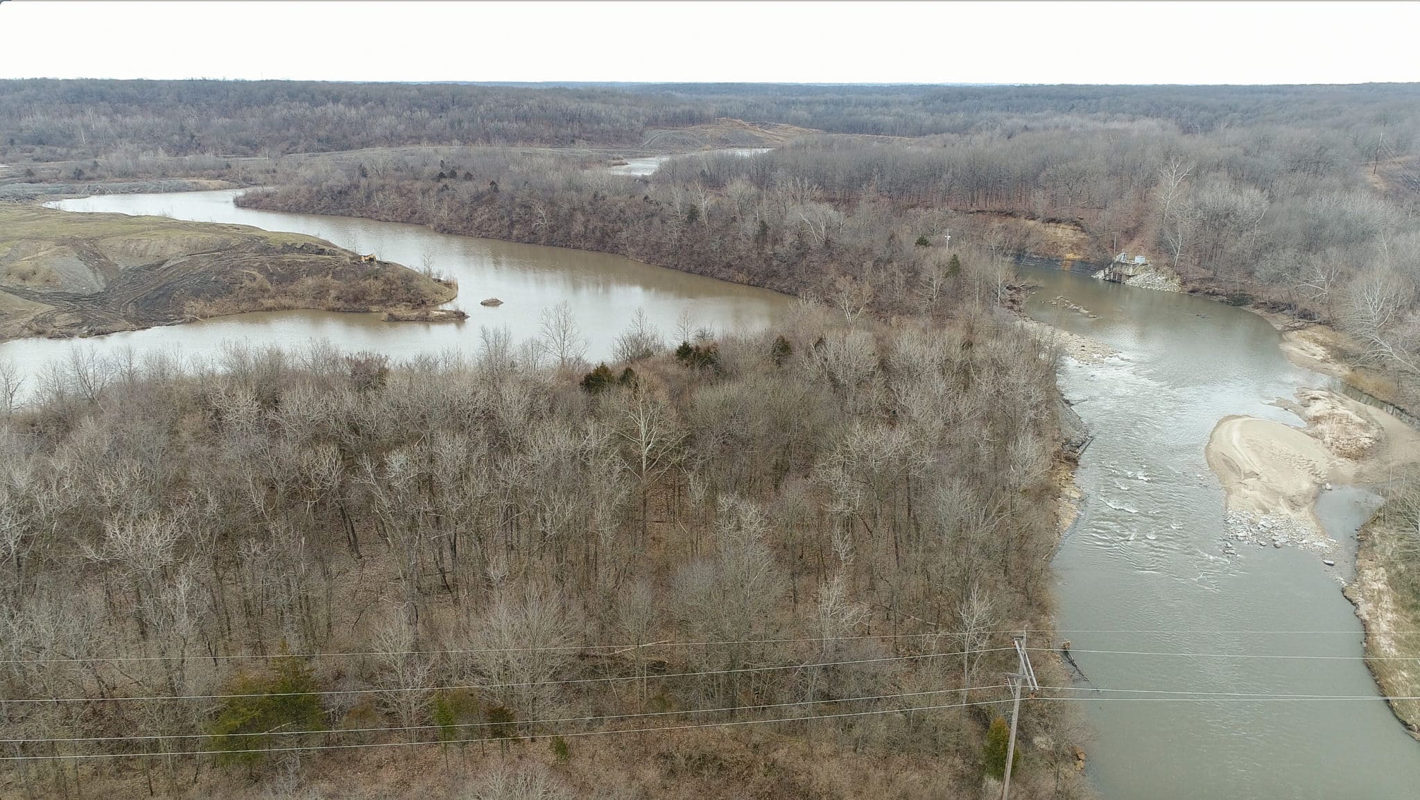
Prairie Rivers Network (PRN) and area citizens have been concerned about Dynegy’s coal ash looming above an eroding river bank on the Middle Fork of the Vermilion River for years. Dynegy’s own report shows the Middle Fork is eroding the river bank at an alarming rate – up to three feet each year. This February, massive flooding raised additional concerns over the possible erosive effects and damage that storm flow events can have.
Site Investigation
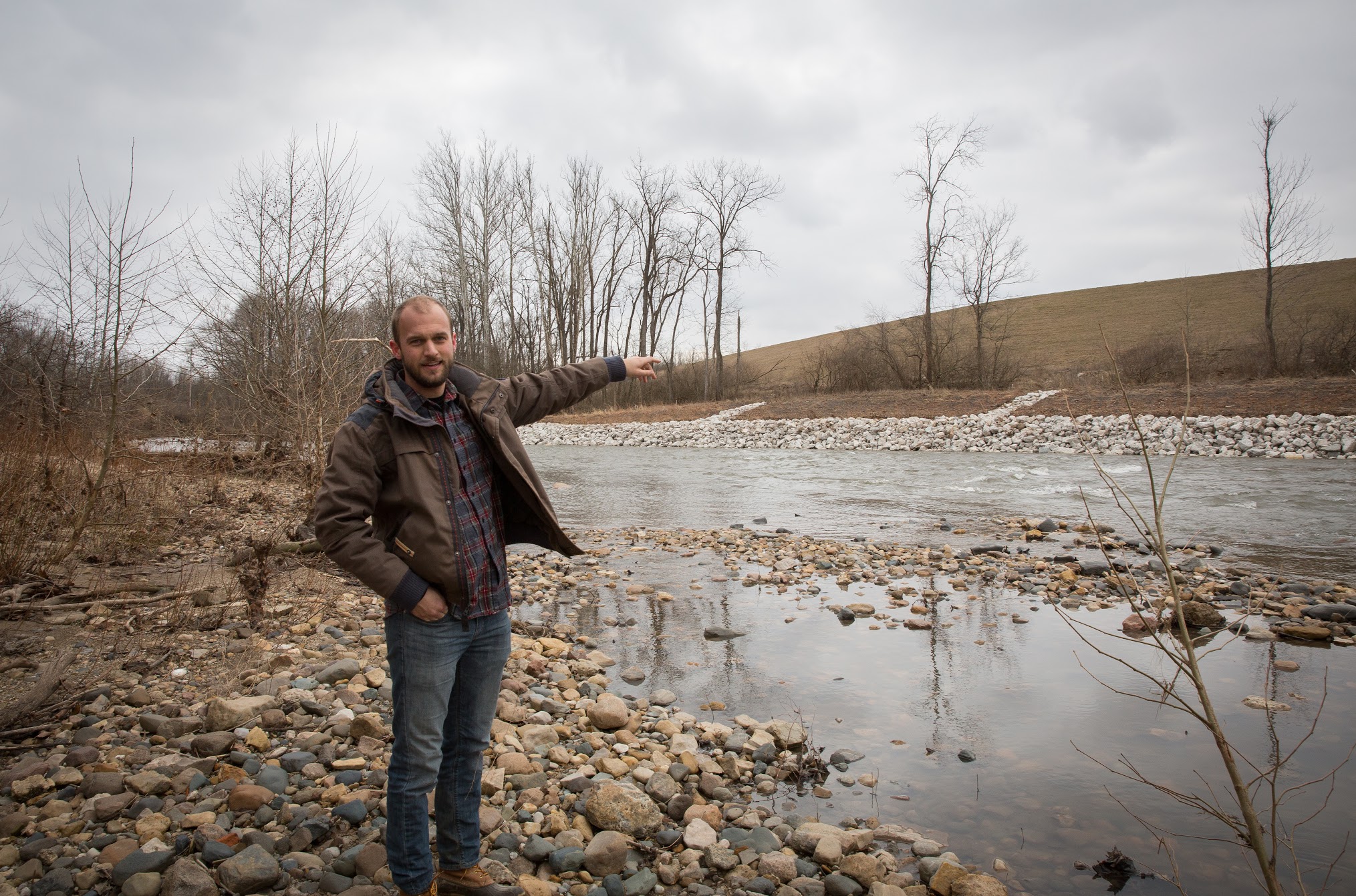
PRN staff Andrew Rehn and Robert Hirschfeld made a site visit on March 8 to investigate post-flooding conditions. They found that erosion had taken place along the coal ash impoundment, yet the Dynegy-owned levee was still intact.
On the other side of the river and a few hundred feet downstream of the Dynegy ash impoundment, signs of erosion on the river bank were observed. Upon follow-up with Illinois of Department of Natural Resources (IDNR), we learned that a 20 foot tall berm separating an old strip mine pond from the Middle Fork had breached.
 Levee Breach
The IDNR confirmed that the February floods caused a failure of almost 150 feet of levee on the banks of the river. The levee separated the river from an abandoned coal mine lake that is located on IDNR land. The coal mine lake was created as a result of strip mining activities during the 1960s, prior to regulations that mandated reclamation or proper levee construction.
Failure of this levee allowed river water to flow into the lake at the location of the breach and out of the natural lake outlet on the southeast end of the lake. Now that flood waters have receded, a 3 ft rise separates the river from the lake where a 20ft levee once stood.
The IDNR was able to respond promptly to investigating the impacts of the breach. The National Park Service, who oversees the National Wild and Scenic River program, was also notified of the levee breach.
The IDNR plans to pursue funding through Illinois’ Abandoned Mine Lands program to fix the levee. The AML program is funded by a fee on active coal mining operations and allows for reclamation of lands that were mined before the historic 1977 federal legislation (Surface Mining Control and Reclamation Act) that began requiring reclamation. Emergency assistance is available through the program when mine-related problems occur suddenly, like the breach of this levee.
The River Will Move Again
The lake levee was constructed more than 50 years ago, before regulations guided proper reclamation of coal mined lands. The company that conducted the mining is long gone – taking their profits to the bank and leaving their mess behind.
This incident highlights the perils of leaving huge dams along the banks of the river. Upstream at the Dynegy Vermilion Power Station, the three huge coal ash impoundments are held back by earthen dams on the river banks. The first coal ash impoundment was constructed in the floodplain of the Middle Fork with the opening of the Vermilion Power Station in 1955 and a second was built in the 1970s. Records for construction of the dams impounding the coal ash are limited – lost to time. We don’t have the engineering specifications or project history for the two older dams on the site.

Dynegy Plans to Leave Coal Ash in the Floodplain
Dynegy, a Texas based energy company, purchased the plant in 2000 and closed it in 2011. They are still responsible for the 3.3 million cubic yards of coal ash at the site. Dynegy has proposed to simply cap their coal ash impoundments and be done with them. Leaving coal ash in the floodplain, vulnerable to the force of the river, with the proposed “cap closure option” is not sufficient to protect local residents, businesses, and Illinois taxpayers from the burden of ongoing pollution and a potential breach. Like the now defunct mining company who left behind a levee which failed in February, Dynegy is leaving a burden for the state and the public to deal with.
While Dynegy continues to propose their short-sighted solutions, PRN and area citizens have raised concerns about the possibility of a disaster similar to those that occurred in Tennessee and North Carolina, where coal ash pits burst, sending tons of toxic sludge downstream. If this occurs on the Middle Fork, we risk ruining a precious natural resource and Illinois’ only National Scenic River.
Prairie Rivers Network and Others Work to Protect the River
Prairie Rivers Network recently took action to stop the ongoing pollution at the site, issuing a 60 day notice of intent to sue Dynegy for violations of the clean water act due to contaminants from the coal ash seeping into the river. The threat of erosion and possible failure of Dynegy’s coal ash dam pose an additional challenge to protect this river. For now, staff at Prairie Rivers Network are doing their best to monitor the site, visiting as often as possible to track erosion and looking for any warning signs of a possible breach.
The local group Eco-Justice Collaborative is holding a People’s Hearing to Protect the Middle Fork on June 11th, 5-8pm at the Bremer Auditorium, Danville Area Community College. The Hearing will include testimony from experts about the risks of leaving the coal ash in the floodplain and residents affected by the TVA coal ash spill in Tennessee will share their story.
If you are interested in learning more or taking action with us, check out Prairie Rivers Network, Eco-Justice Collaborative, and the local citizens’ group, Protect the Middle Fork.


