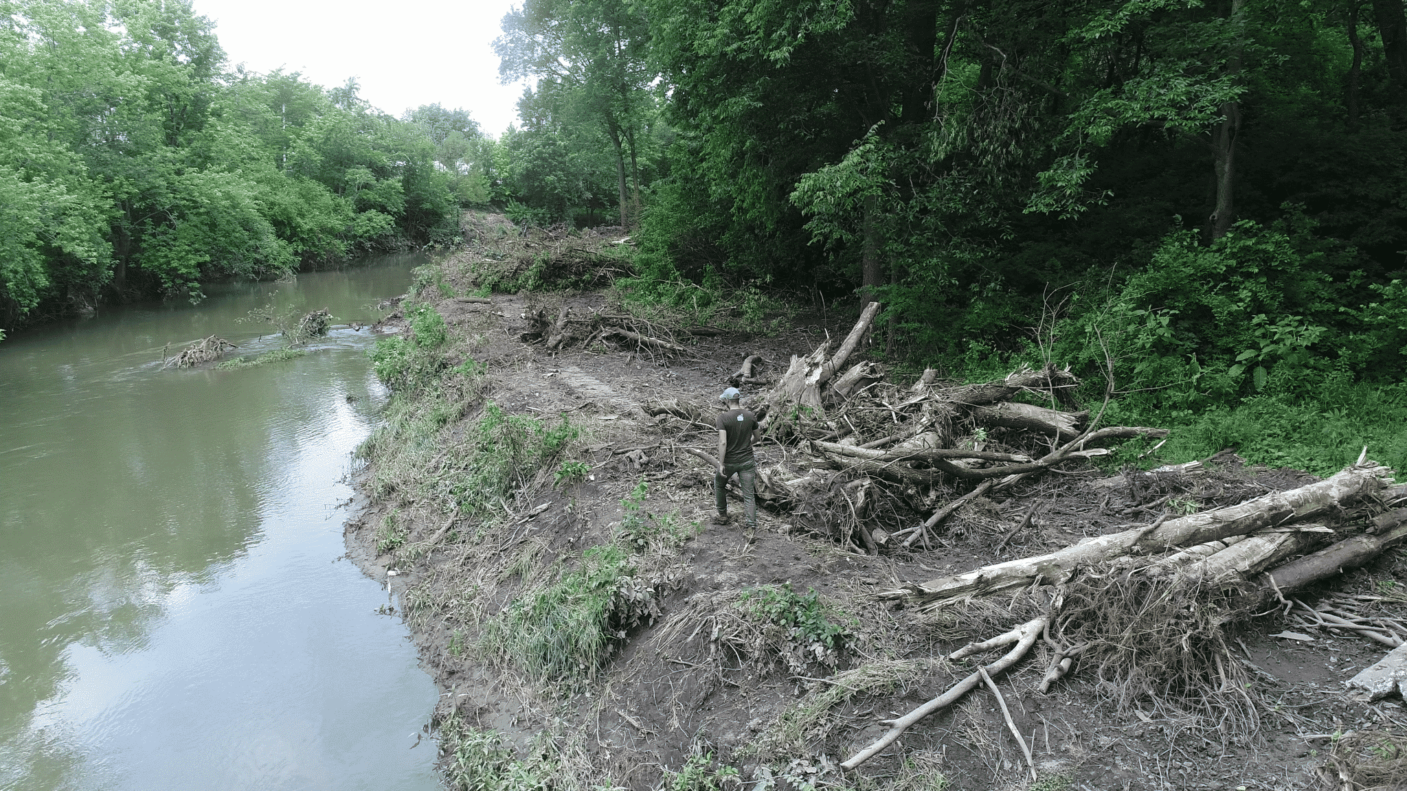
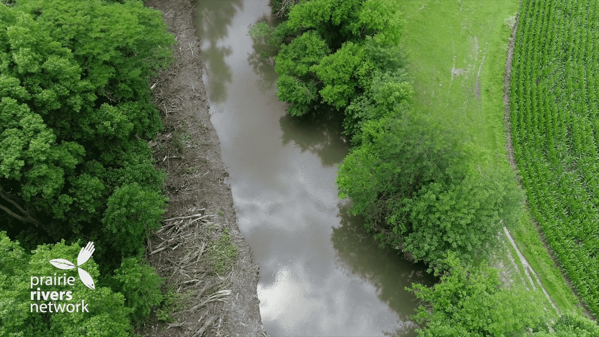
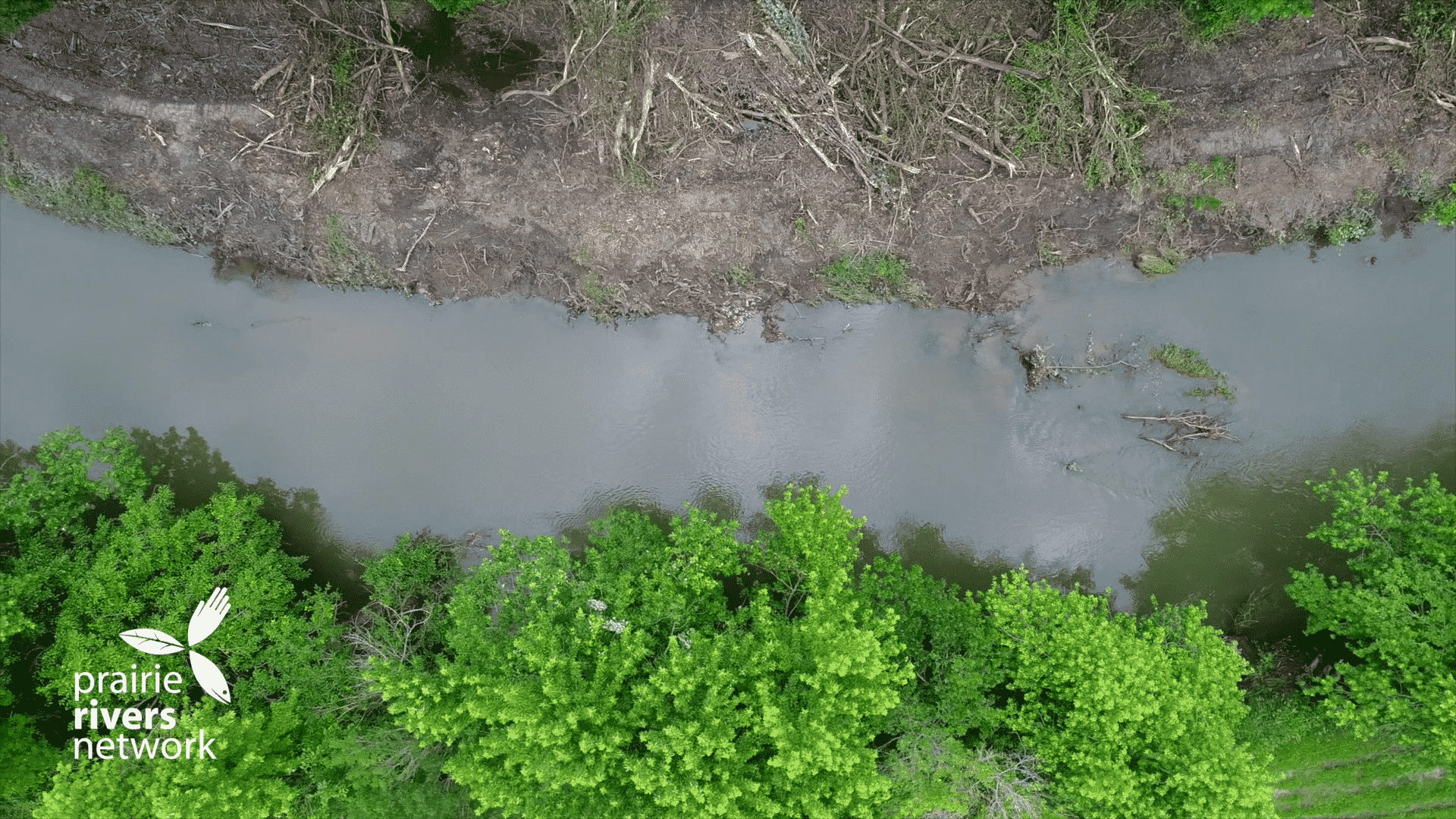
In June 2018, the Upper Salt Fork Drainage District clear-cut nearly a mile of riverbank on the Salt Fork River, removing all vegetation and trees (including the stumps) within about 20 feet of the river. This stretch of the river flows past the Heather Hills neighborhood north of St Joseph Illinois, and the deforested riverbank sits on private landowners’ property. The land, which had been lush with trees, brush, and wildlife, is now mud and felled logs, completely devoid of any vegetation. The District has an easement, but none of the residents of the Heather Hills neighborhood were notified that their land would be clear-cut this way.
The Salt Fork is a small river that generally runs from north to south near St. Joseph in the east-central part of the state. As it reaches the town of Sidney, it turns east-northeast eventually meeting with the Middle Fork of the Vermilion River near Danville. Much of the river north of St. Joseph has been channelized with little in the way of vegetation other than agricultural crops on either side. Yet as the river approaches St. Joseph, it takes on a more natural state. Towering trees enclose the river, and as the water passes the Heather Hills neighborhood, vast tracts of vegetation fill out the bend before reaching the Flatville Road bridge.

After discovering workers clearing their land and what appeared to be a rudimentary road on their property, a few homeowners reached out to Upper Salt Fork Drainage District commissioners requesting an explanation of why work was being done without notice. It was explained that the work was routine maintenance to remove trees that had fallen into the waterway. Further calls from landowners to the drainage district were reportedly ignored or answered with hostility.
PRN called various government agencies and was told that the trees were causing flooding and the work was reportedly done to reduce flooding in the neighborhood.
These stories don’t necessarily line up. Was the goal to remove trees that had fallen in the river, or was clear cutting the riverbank itself the goal? Given the conflicting explanations and no work plan, we are left to wonder why the Drainage District thought this was a good idea.
If the work truly was for maintenance removal of fallen logs from the river, the Upper Salt Fork Drainage District went about it in an aggressive, devastating, and seemingly unnecessary way. The district downed many live trees, displaced wildlife, and destroyed a good portion of what little natural habitat remains on that section of the Salt Fork. If the purpose was to access fallen trees in the river, the other side of the river provides easier access from grassed farmland with just a few trees.
PRN estimates that approximately an acre of wildlife habitat was destroyed, replaced with muddy bare earth. What is the plan for this stripped area now that all the vegetation has been removed? Will it be re-seeded? When, and with what? We do not know, and neither do the landowners who have been asking questions.
Clear cutting trees causes real harms to the river system. Invasive species like garlic mustard or bush honeysuckle may soon take root in the area. Without the deep roots of trees and native vegetation to reinforce the soil, erosion of the riverbank will increase. Eventually, the river will erode the landowner’s property and that eroded soil will pollute the water and fill in river bed. Trees absorb excess nutrients flowing from upstream farm fields and shade the river. Without shading on the east side, water temperatures will rise, degrading fish and other wildlife habitat. Trees also help regulate the main channel of rivers in high flows, concentrating the fastest flow into the main channel and helping to prevent sediment buildup on the riverbed.
The neighborhood suffers from extensive flooding during large rainstorms, yet this work will not solve that problem. The felled trees could make flooding worse due to their potential to be swept downstream during the next big rain event and create a logjam at the bridge. The trees in the floodplain are not the root cause of the flooding in the neighborhood.
Absent a more detailed study, the flooding likely happens because of the land use changes upstream, including field drainage tiles and stream channelization, which send vast amounts of water off of the land as quickly as possible into the river and, consequently, into the homes of the Heather Hills neighborhood. The bridge just downstream of the neighborhood slows down the flow and could also be a main driver of flooding.
Without communication of a clear plan of action from the District, we’re left with unanswered questions. Why were landowners not consulted or notified? Was the clear cutting necessary? Why not access the river from the other bank? What is the work plan and next steps? Will the bank be re-seeded by the District, and if so, with what and when?
The Salt Fork River needs to be shared by wildlife, fish, residents, visitors, and people who live alongside it. It is imperative that we support all uses of the river and that plans are developed through an inclusive process with all stakeholders. We need to think about those who are downstream and how our stream management will impact them. It is time that we use ecologically sound practices that ensure the needs of people and wildlife can coincide.


