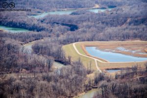
The Middle Fork of the Vermilion River, one of Vermilion County’s beautiful and best natural resources, is under constant threat from coal ash.
Dynegy’s enormous coal ash ponds sit perched on the banks of the Middle Fork of the Vermilion River, Illinois’s only National Scenic River. The National Park Service, steward of the National Scenic Rivers, is calling for Dynegy’s coal ash to be removed from the floodplain in a letter to the Corps. The letter states:
“The NPS has expressed concern about the current location of the fly ash disposal ponds, within the active meander pattern of the River, as well as the potential detrimental effects of pond discharges to the water quality value of the River. The location of the fly ash disposal ponds is not consistent with the purpose of the River and the removal of the ash ponds as well as associated embankments, streamside pump house, and non-operational infrastructure that remains within the river corridor would protect and enhance the River and its values.”
Dynegy, a Texas based energy producer, owns and operates the Vermilion Power Station, which produced the 3.3 million cubic yards of coal ash that is stored along the banks of the Middle Fork. The plant closed in 2011, but the ash remains in the floodplain.
Coal ash is the solid by-product that is left over after coal is burned for electricity – much like ash that is left after burning wood in a fire, except coal ash contains toxic materials like mercury, arsenic, selenium, cadmium and chromium.
In the past decade, concern over coal ash and its storage has increased immensely. The threat of coal ash storage was brought to national focus in 2008 when a massive coal ash impoundment failed at the Kingston Fossil Plant in Tennessee and released a billion gallons of coal ash into nearby rivers and homes.
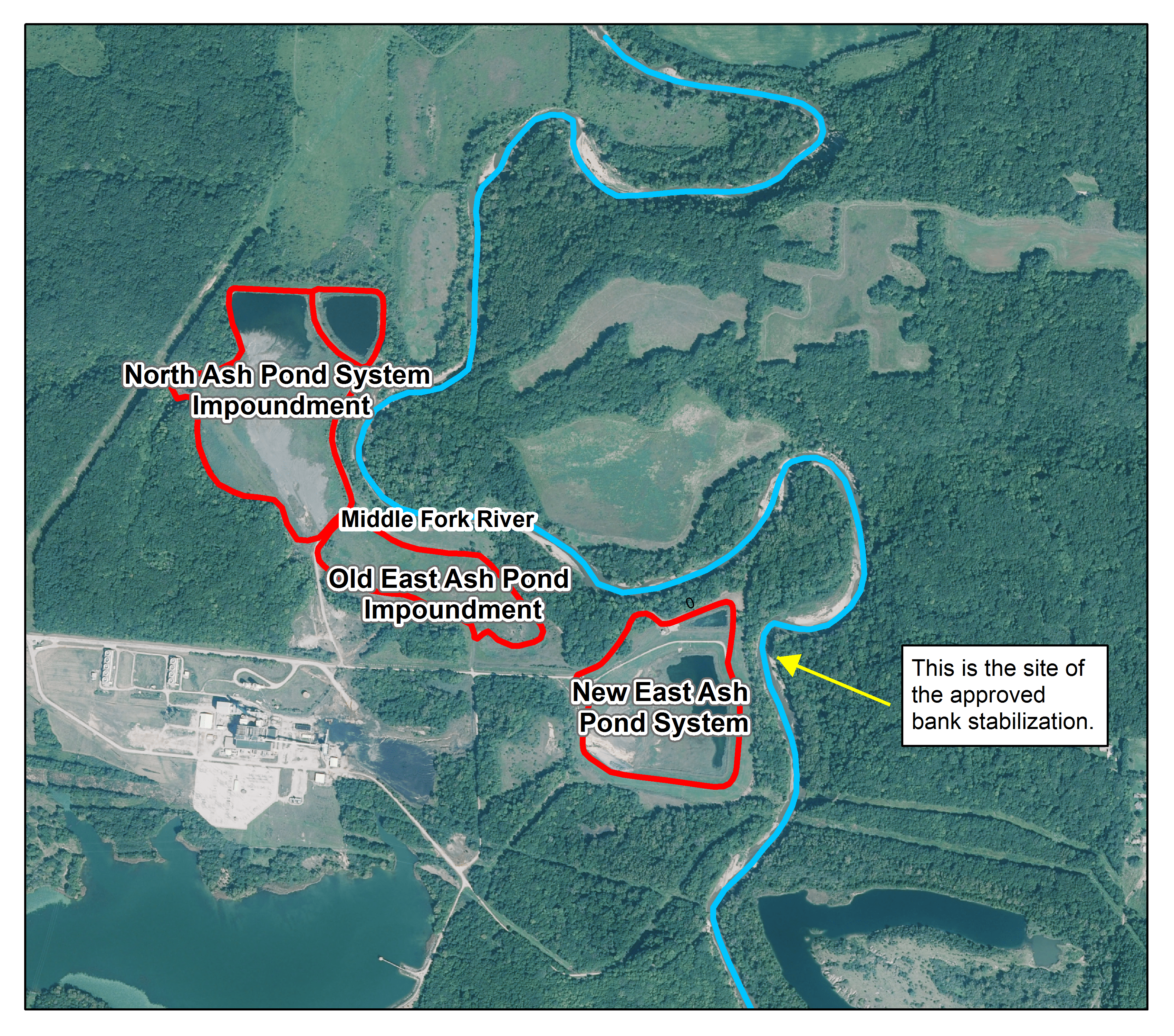
Dynegy’s coal ash is stored in three large ponds perched along the banks of the river (see Figure 2). The newest of those ponds, the New East Ash Pond, was constructed in 1989 and expanded towards the river in 2002. The river is rapidly eroding the bank to the east of the pond, threatening to destabilize the impoundment and spill ash into the river.

Due to the National Scenic River designation, Dynegy needs the approval of the National Park Service to build within the waterway of the river. Dynegy has been applying to construct bank armoring along the bank of the New East Ash Pond since 2009, but has until now refused to propose a design that would protect the scenic value of the river. Even the current design will impact the scenic value of the river, but continued rapid erosion would be much worse, so the design was approved.
This bank stabilization project, while necessary, represents another band-aid solution that Dynegy is trying to apply in lieu of taking responsibility for these ponds. The National Park Service considers this project to be a temporary solution:
“In the absence of the immediate removal of the fly ash ponds, the re-establishment of the bank and associated armoring is necessary as a temporary practice for the protection of the River and its values, until such time the ponds are removed.”
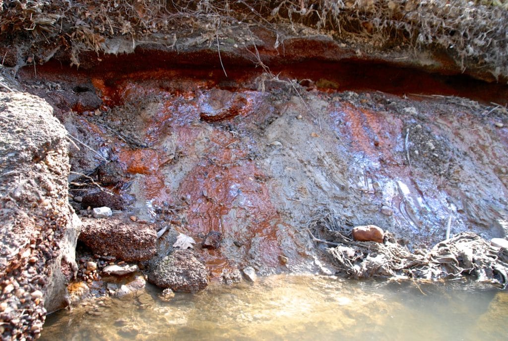
Erosion isn’t the only way this coal ash threatens the Middle Fork. The coal ash in the impoundments is saturated with groundwater, and that groundwater seeps into the Middle Fork, carrying the contaminants found in coal ash. The effect of this seeping is visible in the orange staining on the banks of the river. Dynegy claims orange staining are all along the Vermilion River, not just at Dynegy’s site, but anyone who has actually paddled the Middle Fork knows that to be untrue.

The Illinois EPA should follow the National Park Service’s direction and call for the removal of the coal ash at this site. Unlike the National Park Service, the Illinois EPA has the authority to require Dynegy to remove the ash. It’s time that Illinois EPA owned up to the reality that the only safe solution for this site is to move the ash to higher ground.
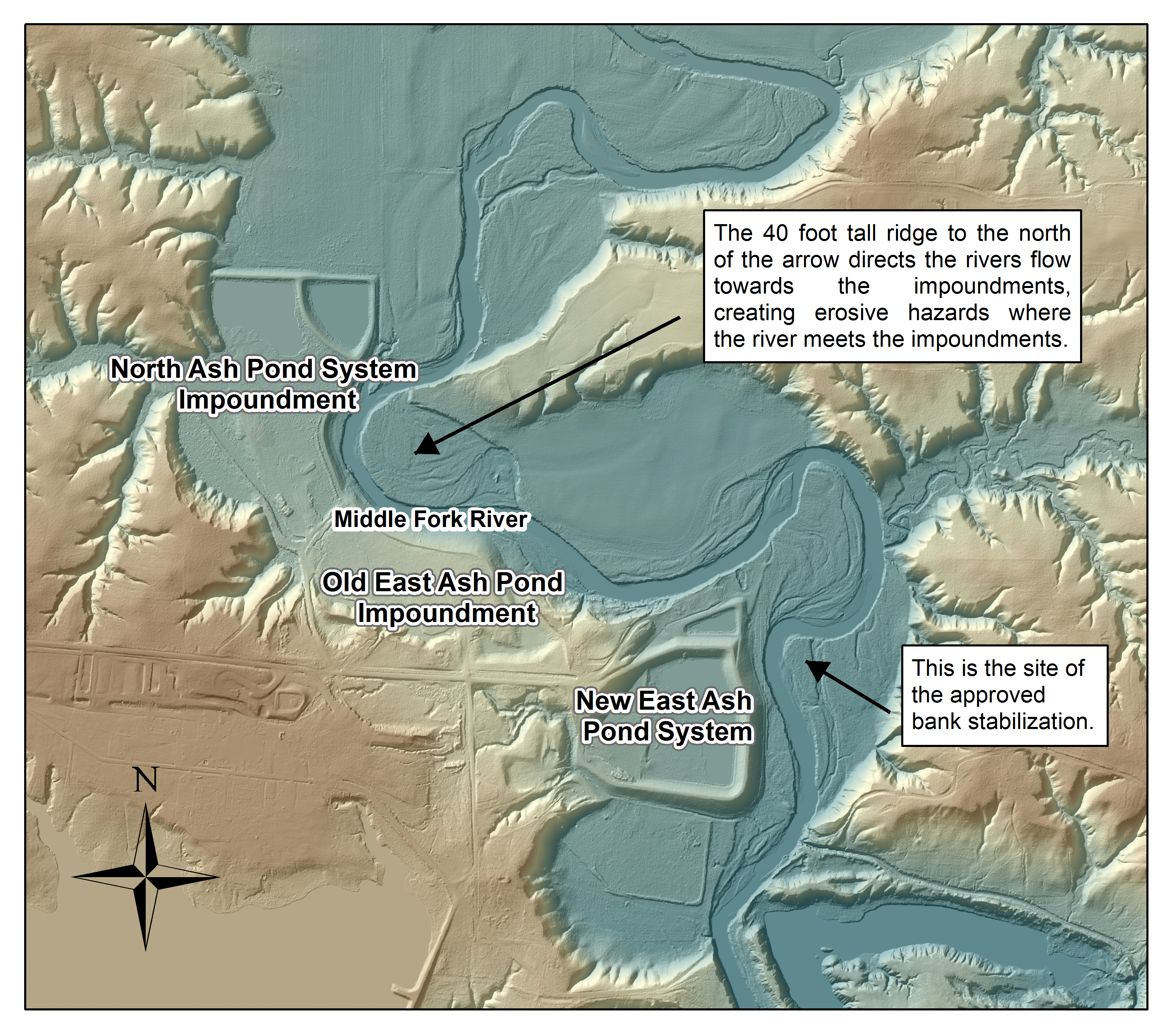
All three of these coal ash ponds are positioned very dangerously within the path of this actively meandering river. The Middle Fork has nowhere else to go but into the impoundments. High resolution elevation data (shown in Figure 4) shows that the river is wedged between high bluffs to the east and the ponds to the west, and its general trajectory is westward.
River armoring is a band-aid solution. The armoring will eventually fail, and Dynegy won’t be here forever to keep replacing it. If Dynegy doesn’t remove the coal ash at this site, one day it will be the tax payers who have to bear the burden of the cost this coal ash.
For more information, see Dynegy’s Coal Ash Problem.


