
On October 16th, the Illinois Department of Natural Resources announced a closure of both the Middle Fork of the Vermilion River and the Vermilion River.
The Middle Fork of the Vermilion River from Potomac to the confluence with the Vermilion River, and the Vermilion is closed from the confluence to the state line with Indiana. The notice from the Illinois Department of Natural Resources (IDNR) was a bit light on the reason for the closure, stating that a “neighboring lake embankment” had seepage. Like many of you, our first question was whether this was related to the coal ash impoundments at Dynegy.
The short answer: The recent river closure is not related to Dynegy’s coal ash ponds at the retired power plant. An old coal mine pond on the opposite side of the river and a few miles downstream is the source of the problem.
Here’s What’s Happening
PRN was able to connect with staff at the IDNR. They told us that a consultant for the Department identified three notable seeps in the earthen embankments that separate the Middle Fork from Clear Pond (sometimes called Clear Lake), an old strip mine pond now used for recreation. One of the seeps was flowing at approximately 20 gallons per minute, which is substantial enough to raise alarm.
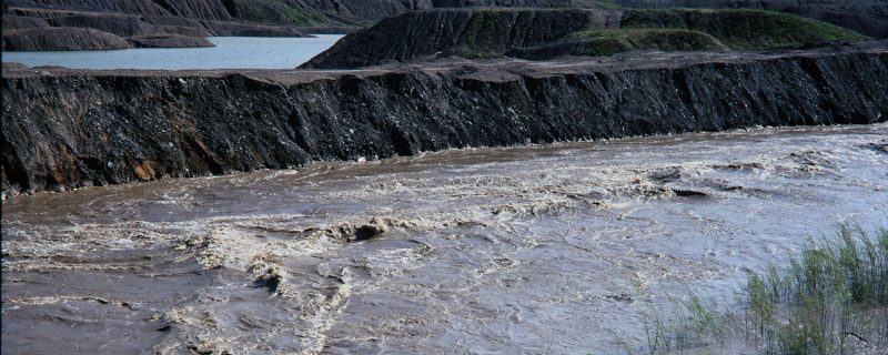
Seeps are water flowing through the embankment, from the pond and into the river. The seeps are driven by the higher water levels in the pond, where the water level is normally 13 feet higher than the Middle Fork. The concern is that the seeps might grow, drive erosion, and compromise the stability of the embankment that separates the pond from the river.
A collapse could substantially empty the pond and create a torrent on the river that could be dangerous for anyone in the water. IDNR chose to close the river and start working on an immediate solution to stem the flow and ensure the embankment is stable. That’s all we know now.
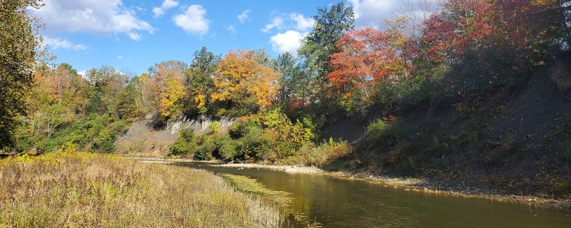
Old mine Embankments on the Middle Fork
Surface coal mining that occurred in the area from the 1920s through the early 1970s has significantly altered the location of the Middle Fork channel and its historic floodplain. Before coal mining, the river meandered through a wide, flat floodplain that allowed floodwaters to spread out during seasonal high flow events. Those long-ago mining companies created huge embankments to physically move the Middle Fork against the bluffs on the west side of its floodplain. The mines and embankments have now long been abandoned. Water has accumulated in the strip mines to form the ponds that make up a substantial portion of Kickapoo State Park and Kennekuk County Park, including Clear Pond.
There are multiple locations where these old mining embankments are creating problems for the Middle Fork. In 2018, an embankment along the east side of the Middle Fork failed during a massive flood, lowering another adjacent strip mining pond to the level of the Middle Fork. That gap was widened by the more recent flooding this August.
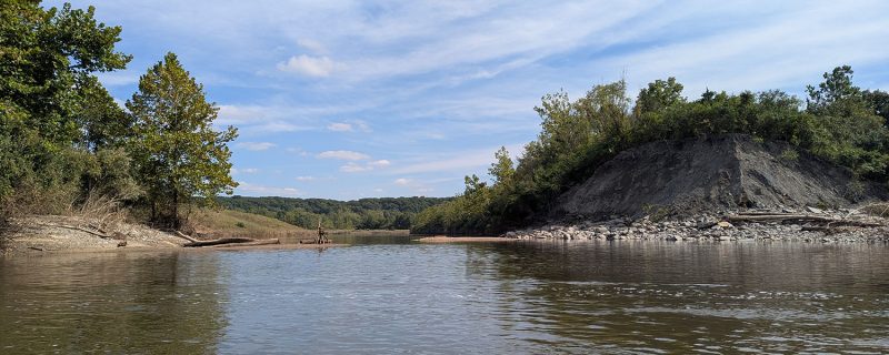
These embankments were built long ago without proper engineering design, leading to problems like we are seeing today. As described in more detail below, when problems occur on “abandoned mine lands (AML),” state support and federal funding is available to help. In Illinois, IDNR is the state agency that works on these AML problems. Prairie Rivers Network plans to continue working with IDNR and the public regarding the short and long term solutions for the Middle Fork and other AML problems in Illinois.
Updates on Dynegy’s Coal Ash
Dynegy’s coal ash along Illinois’ only National Scenic River remains a top concern for Prairie Rivers Network. The most recent river closure is not related to Dynegy or the coal ash. However, there has been construction at the site in recent months. This August, PRN and the public learned that the riverbank next to Dynegy’s coal ash on the Middle Fork hit a critical point in June that triggered action from the company to stop further erosion. In September, Dynegy began work on that project, laying down tons of rocks and small boulders on the eroding areas.
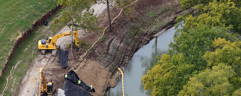
While this sort of armoring is not in line with the outstanding resource values that make the Middle Fork a National Scenic River, it was approved on an emergency basis to prevent a collapse of the coal ash impoundments. The riprap will be removed by Dynegy when the coal ash is removed from the floodplain and no longer poses a threat to the river.
The public is waiting on the Illinois EPA to finalize Dynegy’s closure construction permit so removal of the coal ash can proceed. We are hopeful that a draft permit will be released for public comment soon.
Abandoned Mine Lands
The embankments along the Middle Fork are considered Abandoned Mine Lands (AMLs) and IDNR has staff and funding to help address AML issues like the current embankment issue along Clear Pond. AMLs are coal mining sites that were mined prior to Congress’ 1977 passage of the Surface Mining Control and Reclamation Act. Before that law, coal companies were not required to clean-up or reclaim damaged land and water after mining.
To reclaim the thousands of pre-1977 mine sites, the law set up the AML Reclamation Program. Current coal companies pay a fee per ton of coal mined to support the cleanup of the industry’s decades-old abandoned sites. Much needed additional funding was added to the program from the 2021 Bipartisan Infrastructure Law thanks in part to advocacy from PRN and similar organizations across the nation’s coal-producing states.
The IDNR, through its Office of Mines and Minerals and Abandoned Mined Lands Reclamation Division, administers Illinois’ AML program. The Illinois AML program has been working to reclaim AML sites at Kickapoo State Park and along the Middle Fork for decades. A large-scale reclamation project lowered the water level behind one embankment to prevent failure in the 1990s, and numerous AML reclamation projects have continued throughout the park since that time.
There are AMLs throughout the southern three-quarters of Illinois, where coal mining historically occurred. Many of these areas haven’t had an active coal mine in decades, but the legacy of the coal industry remains. Several different types of AML problems exist, including exposed coal waste known as GOB and slurry, openings to old underground mines, polluted water, hazardous equipment, surface sinking or subsidence, steep embankments, and more.
In January 2026, PRN joined other organizations to oppose congressional action that raided $500 million from the AML fund. PRN is committed to continue working to ensure that adequate funding is available to address the legacy of AMLs across Illinois and our country, so that issues like those occurring with Clear Pond and the Middle Fork can be addressed for the benefit of the environment and people.